Rancho La Puente
Rancho La Puente
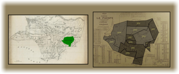
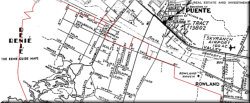
Rancho La Puente was a ranch in the eastern San Gabriel Valley that, in its fullest extent, measured 48,790.55 acres (200 km2), and remained intact until about 1870. By modern landmarks, the ranch extended from San Gabriel River on the west to just west of the 57 Freeway on the east and from Ramona Boulevard/San Bernardino Road on the north to the Puente Hills on the south. All but 40 acres (160,000 m2), which fall within Orange County, are within Los Angeles County. Today, the present communities of Avocado Heights, Bassett, Baldwin Park, San Dimas, Rowland Heights, Hacienda Heights, City of Industry, La Puente, Walnut, Covina, West Covina, and small sections of South El Monte and Irwindale are contained within the old boundaries of Rancho La Puente: Read More from Wiki
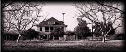
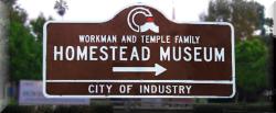
Generally, the rancho land was in the hands of the Native Indians, Spain, Mexico, and now the U.S.A. John Rowland and William Workman obtained the land from Mexico in 1841 and in 1867 they divided the rancho acreage equally between them.
For the actual land division numbers between Rowland and Workman- click here